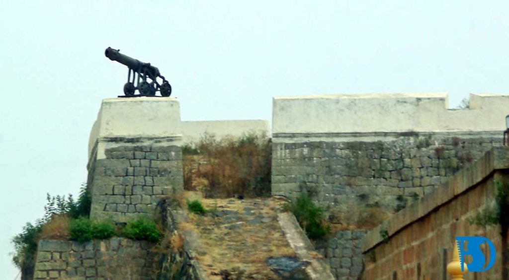
Here is a list of all the top Incredible forts in India that one should definitely visit . With the interesting tales and the intricate structures, these forts are truly one of their kind. Take a look at all the marvels you should visit !
- KANGRA FORT, Himachal Pradesh – A Himalayan Wonder
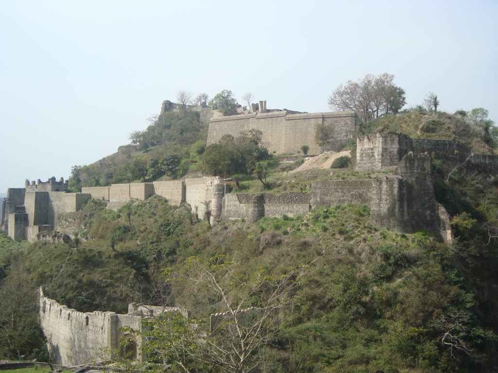
The Kangra Fort was built by the royal Rajput family of Kangra State (the Katoch dynasty), which traces its mythological origins to the ancient Trigarta Kingdom, mentioned in the Mahabharata epic. It is the largest fort in the Himalayas and probably the oldest dated fort in India. The history of the fort dates back to 4th century BC and thus it is counted among the few prominent historical remains of Kangra. It was constructed by the Katoch Dynasty. The fort was under the possession of different dynasties starting from Mahmud of Ghazni to Ranjit Singh, the Maharaja of Punjab. It is during the reign of Mughal Emperor Jahangir, the fort was controlled by an appointed governor to regulate the turbulent chiefs of the hill. Sikhs were the last Indian ruler who possessed this fort before handing it over to the British Government. Head to one of the oldest forts in India to get a virtual experience of time travel. The perfect blend of rich history and scenic beauty, the Kangra Fort lies on a patch of land between the Manjhi and Banganga rivers. Built by the kings of Katoch, one of the oldest living dynasties, the fort is said to be the largest fort in the Himalayas. Its strategic position atop a hill, overlooking the surrounding areas made it particularly prominent.From the fort, enjoy open vistas of the hilly landscape, arid at places and lush at others. Stand on its ramparts and gaze at the surrounding craggy peaks to understand why it was considered impregnable at one time!
Exploring the fort will take you straight into the pages of history. Surrounded by majestic gateways and doors, it boasts vast courtyards and ancient temples within its premises. A good solid hour would be enough to take a tour around the fort. However, to understand the appeal that drew Hindu rulers, Mughal and Sikh conquerors and later the British over different periods of time, would take ages. Today, tourists enjoy a short climb to the top of the fort to drink in spectacular sights. It is a good opportunity for photography as well. To get a more comprehensive overview of the fort’s history, visitors can head to the Maharaja Sansar Chand Katoch Museum, situated right next to the fort.
AMER FORT, Rajasthan – A Timeless Beauty
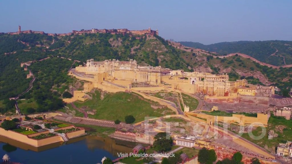
Amer Fort or Amber Fort is a fort located in Amer, Rajasthan, India. Amer is a town with an area of 4 square kilometres (1.5 sq mi) located 11 kilometres (6.8 mi) from Jaipur, the capital of Rajasthan. The town of Amer and the Amber Fort were originally built by the Meenas, and later it was ruled by Raja Man Singh I. Located high on a hill, it is the principal tourist attraction in Jaipur. Amer Fort is known for its artistic style elements. With its large ramparts and series of gates and cobbled paths, the fort overlooks Maota Lake which is the main source of water for the Amer Palace. Just 11 km outside Jaipur, lies this magnificent Amber Fort (Amer Fort), sitting atop a hill, and rising like a sentinel guarding the city. Commissioned in 1592 by Maharaja Man Singh I, the fort is a fine blend of Rajput and Mughal architectural styles, and boasts a grand palace, temples and several ornate gates. Built entirely of red sandstone with white marble work, the UNESCO World Heritage Site is a picture of opulence and grandeur, set against a stark desert backdrop and rolling hills.
One can either walk up the wide winding uphill road to reach the main gate of the fort or hire a cab. As you get closer to the massive gate, you realise why it was considered almost impregnable by the enemy, when the royal family used to reside here, before they shifted the capital to Jaipur. As you enter, you cross the Suraj Pol (sun gate), which leads to the main courtyard called Jaleb Chowk. Diagonally opposite is the Chand Pol (moon gate). From Jaleb Chowk, a flight of stairs leads up to the small Siladevi Temple, whose doors feature relief work in silver.
The main palace is up next. It includes the Diwan-e-Am (hall for a private audience with the king) with carved columns and latticed galleries, the king’s apartments, the gate Ganesh Pol with beautiful arches, and Jai Mandir or Sheesh Mahal. Stand at one of the many arched windows of the palace and take in the rolling shrub land stretching up to the horizon and the scenic Maota Lake at the foot of the fort. Even after centuries, it’s easy to imagine yourself as a Rajput king, who would stand here and survey his kingdom.
Sheesh Mahal or the mirrored palace is one of the most popular attractions here that draws the largest number of tourists. It is breathtaking with fine marble work and cut-glass and mirror inlaid designs on ceilings and walls. It is said that at night, as earthen lamps flickered inside the hall, the numerous mirrors reflected the light, creating the atmosphere of a start-lit sky. Hire a guide or an audio guide to know more about the legends of the fort. In the evening, watch history come alive in a spectacular sound and light show.
JAIGARH FORT, Jaipur – The Fort Of Victory
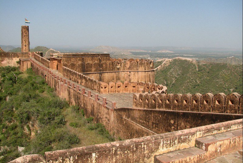
Jaigarh Fort is situated on the promontory called the Cheel ka Teela (Hill of Eagles) of the Aravalli range; it overlooks the Amer Fort and the Maota Lake, near Amer in Jaipur, Rajasthan, India. The fort was built by Jai Singh II in 1726 to protect the Amer Fort and its palace complex and was named after him.
The fort, rugged and similar in structural design to the Amer Fort, is also known as Victory Fort. It has a length of 3 kilometres (1.9 mi) along the north–south direction and a width of 1 kilometre (0.62 mi). The fort features a cannon named “Jaivana”(Jaivana Cannon), which was manufactured in the fort precincts and was then the world’s largest cannon on wheels. Jaigarh Fort and Amer Fort are connected by subterranean passages and considered as one complex.
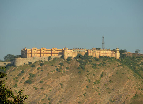
NAHARGARH FORT , Jaipur – A Historic Structure
Built mainly in 1734 by Maharaja Sawai Jai Singh, the king of Jaipur, the fort was constructed as a place of retreat on the summit of the ridge above the city. Walls extended over the surrounding hills, forming fortifications that connected this fort to Jaigarh, the fort above the old capital of Amber. Though the fort never came under attack during the course of its history, it did see some historical events, notably, the treaties with the Maratha forces who warred with Jaipur in the 18th century. During First War of Independence of India of 1857, the Europeans of the region, including the British Resident’s wife, were moved to Nahargarh fort by the king of Jaipur, Sawai Ram Singh, for their protection.The fort was extended in 1868, during the reign of Sawai Ram Singh. In 1883-92, a range of palaces was built at Nahargarh by Dirgh Patel at a cost of nearly three and a half lakh rupees. The Madhavendra Bhawan, built by Sawai Madho Singh had suites for the queens of Jaipur and at the head was a suite for the king himself. The rooms are linked by corridors and still have some delicate frescoes. Nahargarh was also a hunting residence of the Maharajas.
Until April 1944, the Jaipur State government used for its official purposes solar time read from the Samrat Yantra in the Jantar Mantar Observatory, with a gun fired from Nahargarh Fort as the time signal.
CHITTORGARH FORT , Rajasthan – Fort With Many Waterbodies
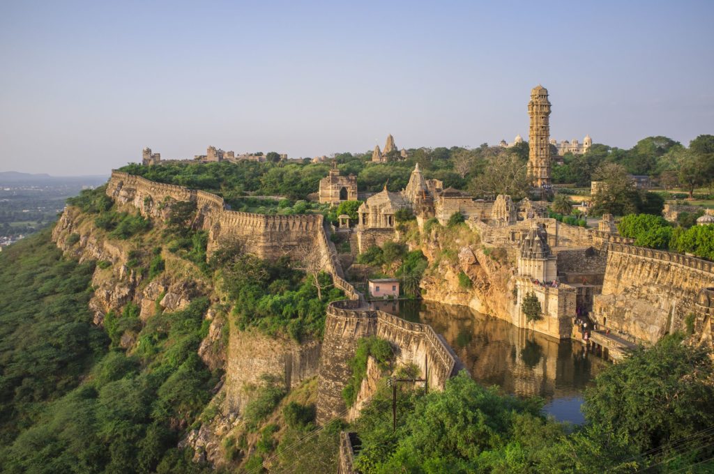
The Chittor Fort or Chittorgarh is the largest fort in India. It is a UNESCO World Heritage Site. The fort was the capital of Mewar and is located in the present-day town of Chittor. It sprawls over a hill 180 m (590.6 ft) in height spread over an area of 280 ha (691.9 acres) above the plains of the valley drained by the Berach River. The fort precinct has several historical palaces, gates, temples and two prominent commemorative towers.One of the most glorious symbols of the indomitable Rajput spirit is the Chittorgarh Fort. Set atop a 180-m-high hill and spread over an area of 240 hectare, it presents a formidable sight. Legend has it that the fort was constructed by Bhima, one of the Pandavas from the epic Mahabharata. It is an imposing structure that rings with the stories and tragedies of the past and the tales of extraordinary men and women. A one-kilometre road winding through foothills leads to the fort and takes visitors through seven gates before reaching Rampol (gate of Ram), one of the entry gates still in use. While going from the second to the third gate, one can see two cenotaphs (chattris) that have been built in honour of Jaimal and Kalla, who laid down their lives during the siege by Mughal emperor Akbar in 1568. The main gate of the fort is Surajpol (sun gate).
The fort has some of the most magnificent monuments, which include the Vijaya Stambha, the Kriti Stambha, Rana Kumbha’s palace, Rani Padmini’s palace, a temple dedicated to Meera Bai and many others. It also houses a number of Jain temples. From the top of the fort, catch a spectacular sight of the Chittorgarh city sprawled at the base of the fort.
MEHARANGARH FORT , Jodhpur – Charm Of The Blue City
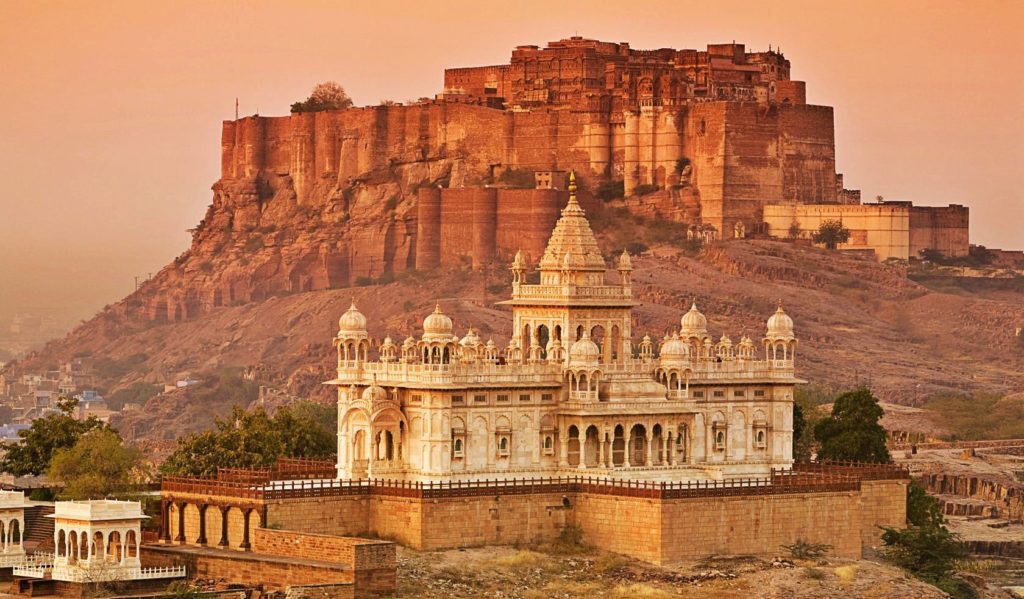
Mehrangarh, located in Jodhpur, Rajasthan, is one of the largest forts in India. Built in around 1459 by Rao Jodha, the fort is situated 410 feet (125 m) above the city and is enclosed by imposing thick walls. Inside its boundaries there are several palaces known for their intricate carvings and expansive courtyards. A winding road leads to and from the city below. The imprints of the impact of cannonballs fired by attacking armies of Jaipur can still be seen on the second gate. To the left of the fort is the chhatri of Kirat Singh Soda, a soldier who fell on the spot defending Mehrangarh.A renowned landmark of Jodhpur, Mehrangarh Fort is one of the largest forts in the city. An ideal vantage point for the panoramic view of Jodhpur, one can trek to the top to see the city spread like a blue ocean at the foot of a hill. The fort is a magnum opus known for its exquisite latticed windows, carved panels, intricately decorated windows and walls of the Moti Mahal, Phool Mahal and Sheesh Mahal that sit pretty within the vast, sprawling complex of the fort.
Head next to the Elephant Howdah gallery on the southern side of Shringar Chowk, which displays the elephant seats used by the royals of Jodhpur. The most striking of these is the silver howdah presented to Maharaja Jaswant Singh I (1629-1678), the ruler of Marwar, by Mughal emperor Shah Jahan, as a symbol of honour.You can then proceed to the palanquin gallery, displaying the primary means of transport of royal ladies; the Daulat Khana, literally translating to wealth store, where the royal treasury was kept; the painting gallery, showcasing a marvellous collection of miniature paintings of the Marwar School; cloth gallery, where the plush carpets, rich brocades and heavy velvets of the royals of Jodhpur have been preserved; the Sileh Khana, which was the royal armoury; and galleries where exquisite wooden crafts, cradles and turbans of the princely families can be viewed.There are seven gates that need to be crossed in order to reach the fort. The gates still bear the marks of the battles fought in the past. One of the seven gates has been named Jaya Pol, meaning victory. It was built by Maharaja Man Singh, the ruler of Jaipur, to commemorate his victories over Jaipur and Bikaner armies. Fateh Pol was built by Maharaja Ajit Singh (1861-1901), the ruler of Marwar, to celebrate the defeat of the Mughals.
The work done on the fort is so impressive, famous author, Rudyard Kipling of The Jungle Book fame, once referred to it as “the work of giants”
JAISALMER FORT, Jaisalmer – The Golden Fort
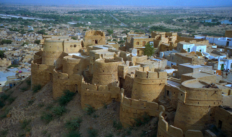
Jaisalmer Fort is situated in the city of Jaisalmer, in the Indian state of Rajasthan. It is believed to be one of the very few “living forts” in the world (such as Carcassonne, France), as nearly one fourth of the old city’s population still resides within the fort. For the better part of its 800-year history, the fort was the city of Jaisalmer. The first settlements outside the fort walls, to accommodate the growing population of Jaisalmer, are said to have come up in the 17th century.
Jaisalmer Fort is the second oldest fort in Rajasthan, built in 1156 AD by the Rajput Rawal (ruler) Jaisal from whom it derives its name, and stood at the crossroads of important trade routes (including the ancient Silk road)
The piece de resistance of the lively Thar desert is a magnificent structure built from yellow sandstone, called the Jaisalmer Fort. Perched atop the Trikuta Hill (triple peaked hill), this imposing fort seems to rise straight from the desert and its gleaming stone fade gives the impression of it being an extension of the magnificent Thar. The magic of this architectural marvel is best witnessed at sunset when the whole fort seems ablaze as it reflects the light from the setting sun, earning it a spot on the list of UNESCO World Heritage Sites. The fort is known for its elaborately carved structure called Raj Mahal, the residence of the erstwhile royal family and the beautiful Jain and Laxminath temples it is home to. The fort also piqued the interest of Oscar winning Indian filmmaker Satyajit Ray, who featured it in one of his films Sonar Quila or the Golden Fortress.This imposing structure was built in 1156 AD by Rajput ruler, Jaisal, and was reinforced by subsequent rulers of Jaisalmer. The fort was the focus of a number of battles between the Bhatis, the Mughals of Delhi and the Rathores of Jodhpur and has four massive gateways.
KUMBHALGARH FORT, Rajasthan – Second Largest Fort In The State
Kumbhalgarh (literally “Kumbhal fort“) is a Mewar fortress on the westerly range of Aravalli Hills, in the Rajsamand district near Udaipur of Rajasthan state in western India. It is a World Heritage Site included in Hill Forts of Rajasthan. Built during the course of the 15th century by Rana Kumbha. Occupied until the late 19th century, the fort is now open to the public and is spectacularly lit for a few minutes each evening. Kumbalgarh is situated 82 km northwest of Udaipur by road. It was the most important fort in Mewar after Chittorgarh Fort.
The impregnable Kumbhalgarh Fort, sitting on a high mountain ridge seems like an impression from the past. Soaring above the surrounding rugged mountainscape, at 3,600 ft, the fort can been seen much before one arrives at its foot. With the second-longest wall in the world, about 38 km long, the Kumbhalgarh Fort is recognised as a UNESCO World Heritage Site. Also, known as the Mewar Fortress, it was the birthplace of the great Rajput king, Maharana Pratap. Everything about the fort has been built to fend off the enemy. From its high position in the Aravalli Hills and its strong ramparts to the four main gates of Aaret, Hanuman, Hulla and Ram Pol, and the Badal Mahal, which was a great hindering force for the enemy, the fort was almost inaccessible. Moreover, the surrounding 13 mountain peaks and numerous watchtowers made it more of a challenge for the enemy. Historical records suggest that it was only once that the fort was besieged. Exploring the fort is an unforgettable experience. From its high vantage points, which provide sweeping views of the Thar Desert, to its beautiful interiors and various sections like the Badal Mahal and the Kumbh Mahal, there’s much to see. There are as many as 360 Hindu and Jain temples inside the fort and devotees can pay obeisance at them. Tourists can also catch the light and sound show organised at the fort under the glittering stars. The fort was built by Rana Kumbha in the 15th century. It was renovated by Maharana Fateh Singh in the 19th century. The Tourism Department of the state government organises a three-day festival to pay a tribute to Rana Kumbha for this splendid architecture.
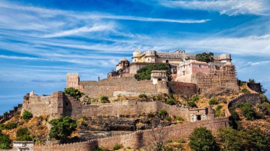
RANTHAMBHORE FORT, Prempura – Fort Amid The Wild
Ranthambore Fort lies within the Ranthambore National Park, near the city of Sawai Madhopur, the park being the former hunting grounds of the Maharajahs of Jaipur until the time of India’s Independence. It is a formidable fort having been a focal point of the historical developments of Rajasthan. The fort was held by the Chahamanas (Chauhans) until the 13th century, when the Delhi Sultanate captured it.In 2013, at the 37th session of the World Heritage Committee, Ranthambore Fort, along with 5 other forts of Rajasthan, was declared a UNESCO World Heritage Site under the group Hill Forts of Rajasthan
Occupying a prominent position atop a hill inside Ranthambore National Park, this mighty fort has withstood several sieges and still stands. It was built in the 10th century and acted as great protection for the Rajput kings against foreign invaders. It is said that Ranthambore Fort was captured by Prithviraj Chauhan in the 12th century, and finally occupied by Alauddin Khalji.
Visiting the fort is a fascinating experience as you can spot diverse fauna along the way. Moreover, several birds can be spotted at eye level as you slowly hike up
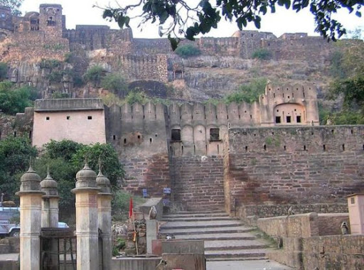
LOHAGARH FORT, Bharatpur – An Iron Marvel
Lohagarh Fort (or Iron Fort) is situated at Bharatpur in Rajasthan, India. It was constructed by Bharatpur Jat rulers. Maharaja Suraj Mal built numerous forts and palaces across his kingdom, one of them being the Lohagarh Fort, one of the strongest ever built in Indian history. The inaccessible Lohagarh fort could withstand repeated attacks of British forces led by Lord Lake in 1805 when they laid siege for over six weeks.Of the two gates in the fort, the one in the north is known as Ashtdhaatu (eight metalled) gate while the one facing the south is called Chowburja (four-pillared) gate.
Monuments in the fort include are Kishori Mahal, Mahal Khas, and Kothi Khas. Moti Mahal (Bharatpur)|Moti Mahal and towers like Jawahar Burj and Fateh Burj were erected to commemorate the victory over the Mughals and the British army. The gateway has paintings of huge elephants.
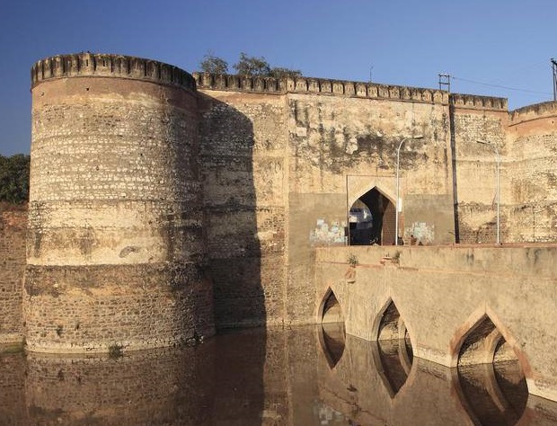
TARAGARH FORT , Bundi – An Impressive Ruin
Taragarh Fort of Rajasthan is undeniably a renowned fort which stands out for its own identity in Bundi, Rajasthan. Taragarh Fort was the only place to an important generous state when it comes to the Rajput charm and grandeur. Taragarh Fort is a huge fort built in 1354 during the peak of Rajput rulers. It was made the capital of main princely states. This unique fort is accessible by a sharp road connecting up the hillside towards its entrance, which is decorated with wild elephants. The fort consists of huge pools etched out of hard rock and its Bhim Burj, which is the leading of the walls, on which is built up a renowned cannon. An outstanding birdeye of the city from this historical fort is one more attraction among explorers. It is believed that the Taragarh Fort was the first Hill Fort in India. The fort is also one of the oldest forts in Rajasthan that have seen a number of battles and rulers from Rajput, Muslim, Maratha and the British conquerors till date.
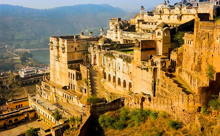
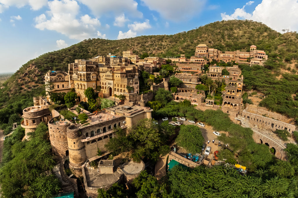
NEEMRANA FORT, Neemrana – A Luxurious Escape
Neemrana is an ancient historical town in Alwar district of Rajasthan, India, 84 km (52 mi) from Gurgaon; 122 km (76 mi) from Delhi and 150 km (93 mi) from Jaipur on the Delhi–Jaipur highway in Neemrana tehsil. It is between Behror and Shahajahanpur. Neemrana is an industrial hub.It is the site of a 16th-century hill-fort occupied by Chauhans till 1947. The erstwhile ruling family is considered to be of the direct lineage of Prithviraj Chauhan. Some distance from Neemrana is another fort, Kesroli in Alwar district, that is one of the oldest heritage sites. Historians trace it to the Matsya Janapada of the Mahabharata times. In Kesroli one gets to see the oldest remains of Buddhist Vihara at Viratnagar where the Pandavas spent the last year of their exile incognito; Pandupole, with the only reclining statue of Hanuman; the samadhi of the ruler saint Bhartrihari. Haryanvi language and culture are followed in this area as it is just a few kilometers away from the border of Haryana and Rajasthan.
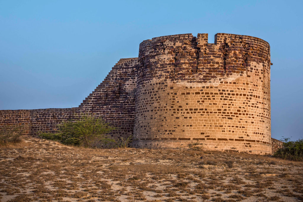
BHUJIA FORT , Bhuj Gujarat -Kutch Pride
Bhujia Fort, also spelled as Bhujiya Fort, is a fort located in the outskirts of the town of Bhuj in the district of Kutch, Gujarat, India. The fort is built atop Bhujia Hill overlooking the town.The fort was constructed for the defense of the city by Jadeja Chiefs. The construction of Bhujia fort was started by Rao Godji I (1715–1718) ruler of Kingdom of Kutch as a sort of outwork defense for Bhuj. However, the major work and completion was done during the rule of his son, Deshalji I (1718–1741). The hill was fortified as a further aid to the defense of the capital, Bhuj. Devakaran Sheth, Diwan of Kutch during Deshalji I took the lead in fortifying the hill. The Fort has seen six major battles since its construction, most of which were fought in the years 1700-1800 AD between the Rajput rulers of Kutch and Muslim raiders from Sindh and the Mughal rulers of Gujarat.
The first major battle at Bhujia Fort was fought during the early part of the reign of Deshalji I, when Sher Buland Khan, who was Mughal Viceroy of Gujarat at that time, invaded Kutch. The army of Kutch was in a precarious condition, when a group of Naga Bawas got the gate of Bhujia Fort opened through a stratagem on pretext of visiting Nag temple for worship and then joined in the fray against Sher Buland Khan’s army, putting them to flight. Since that day Naga Bawa and their leader have had a place of importance in a procession held on Nag Panchami.
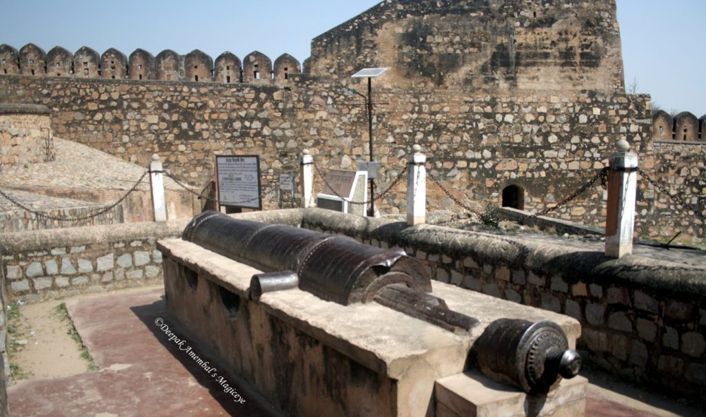
JHANSI FORT, Jhansi – Home To Rani Lakshmi Bai
The construction of the Jhansi fort is ascribed to the Bundela Rajput chief and the ruler of the kingdom of Orchha Veer Singh ju Deo Bundela in 1613. It is one of the strongholds of the Bundelas. In 1728, Mohammed Khan Bangash attacked Maharaja Chattrasal. Peshwa Bajirao helped Maharaja Chattrasal defeat the Mughal army. As a mark of gratitude, Maharaja Chattrasal offered a part of his state, which included Jhansi, to Peshwa Bajirao. In 1742 Naroshanker was made the subedar of Jhansi. During his tenure of 15 years he not only extended the strategically important Jhansi fort (the extension is called Shankergarh), but also constructed other buildings. In 1757, after Naroshanker was called back by the Peshwa. Madhav Govind Kakirde and then Babulal Kanahai were made the subedars of Jhansi. From 1766 to 1769 Vishwas Rao Laxman served as the subedar of Jhansi. Then Raghunath Rao (II) Newalkar was appointed the subedar of Jhansi. He was a very able administrator, increasing the revenue of the state and building both the MahaLakshmi Temple and the Raghunath Temple.
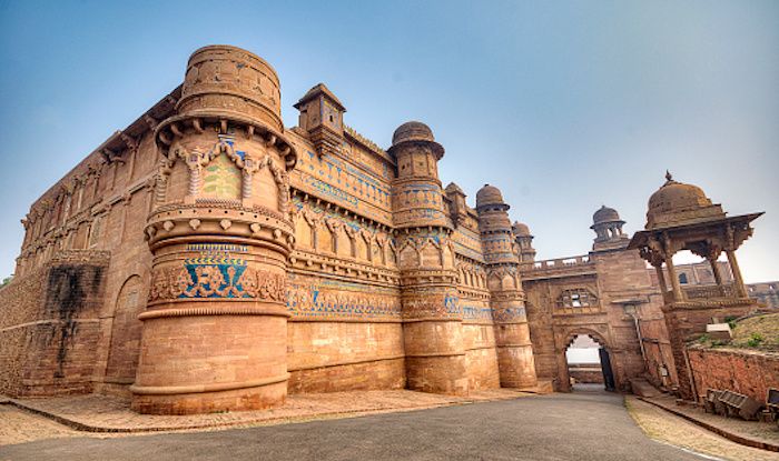
GWALIOR FORT, Madhya Pradesh – An 8th Century Hill Fort
Gwalior Fort is a hill fort near Gwalior, Madhya Pradesh, India. The fort has existed at least since the 10th century, and the inscriptions and monuments found within what is now the fort campus indicate that it may have existed as early as the beginning of the 6th century.
The fort has been controlled by a number of different rulers in its history. The majestic Gwalior Fort, stretching along a 3-km-long plateau, overlooking the city sprawled way beneath, is an unmissable sight. Dominating Gwalior’s skyline, the 8th-century architectural marvel seems to be standing guard at one end of the city. Home to hundreds of kings over the centuries, the palaces, temples and other buildings inside the fort complex have been built over a period of time and show the influences of different dynasties.Among these structures, the most popular is the Teli-Ka-Mandir and Man Singh Palace. Built in the Dravidian style, the Teli-Ka-Mandir temple is covered with fine carvings. The tallest structure in the compound, the 30-m-high temple, dedicated to Lord Vishnu and most probably built in the 9th century, is also considered to be the oldest structure here. With a tall gateway-tower or gopuram, that seems to have been inspired by Dravidian architectural forms, the carvings on the walls of the temple are from northern part of the country. A massive image of Garuda, Lord Vishnu’s mount, is a popular attraction.The Man Singh’s Palace, built by king Man Singh, a Tomar ruler, in the 15th century is known for its brilliant blue ceramic tile design. Visible on the facade of the fortress from a distance, these designs in blue are iconic of the fort itself.Interestingly, the marvels of the fort begin much before you enter the complex, with several massive sculptures of Jain tirthankaras carved into the rock faces in and around the fort. Built by kings of the Tomar dynasty, these large sculptures bestow benign smiles as one walks up to the fort’s main gate. There are nine large and many smaller sculptures, including a stunning 17-m-high standing representation of the first tirthankar, Adinath, located around the complex.The fort complex also houses the Gujari Mahal built by Raja Man Singh for his beloved queen Mrignayani. Other notable structures are Karan Palace, the Jehangir Mahal and Shah Jahan Mahal with fine lattice work, traces of which can be spotted across walls, windows and archways.Walk across the remnants of these palaces, through the bathing area, where it is said kings and queens cooled themselves during the scorching summer months. Nearby is the Jauhar Kund, a tank where women of the royal household self-immolated (jauhar) themselves in in 1231, when Gwalior was on the brink of being captured by sultan Iltutmish. The fort is also home to the illustrious Scindia School.
MADAN MAHAL FORT , Jabalpur – Intriguing With Its Roughness
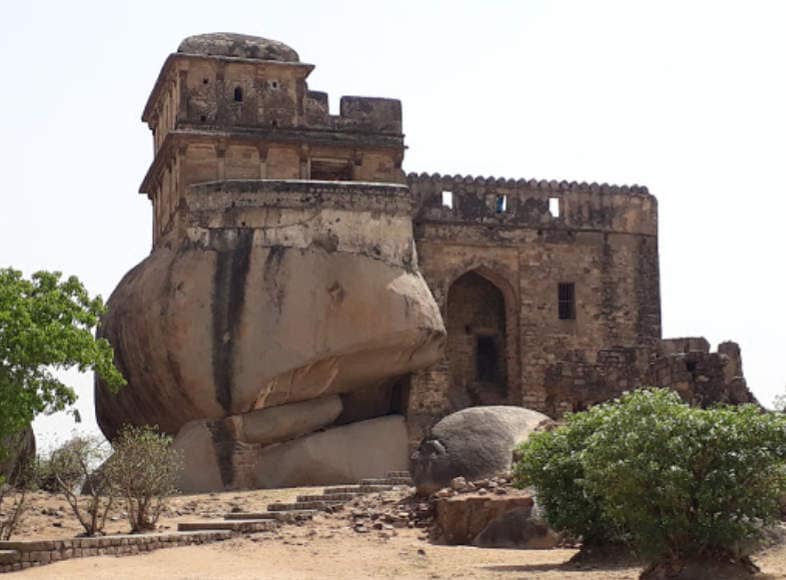
Situated atop a hill in Jabalpur town is a small but enchanting fort of the Rajgond rulers. It was more of a manned post on vigil for invaders now enveloped in shroud of history. The fort dates back to 11th century AD. The fort is well associated with Rani Durgavati the Gond Queen and her son Veer Narayan. Rani Durgavati eventually died fighting the mughals and is hailed as a martyr in Indian history. She also built numerous temples and tanks scattered around Jabalpur chiefly around her Garha principality.The Rajgond rulers reigned over Jabalpur, Mandla and surrounding regions. Madan Mahal is one such fort built by them. Though not exactly an architectural marvel, the little fort is characterized by intrigue of ancient monuments in India.The structure generates an aura of awe being compact and yet fully equipped for martial encounters. The stable, war rooms, small reservoir and main pleasure chamber of the rulers offer visitors much to see and admire.The monument is situated at a height of about five hundred meters on the hill of same name. The Balancing Rock is a huge stone balanced on the tip of another. It is a geological wonder on the way to the fort.
There are many myths floating about the fort of the Gonds. It is said to harbor gold bricks and Gond treasures hidden somewhere in it in accessible underground folds. A tunnel covering a long distance is said to be located somewhere around the precinct – a possible escape route and transportation artery of the Gonds.
RAIGAD FORT, Raigad – Beautiful Fort By The Marathas
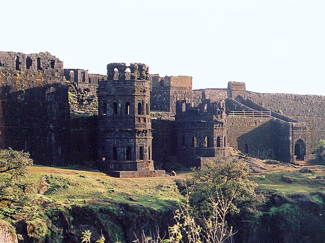
Raigad is a hill fort situated in Mahad, Raigad district of Maharashtra, India. Many constructions and structures that we see on raigad were built by Chhatrapati Shivaji when he made it his capital in 1674 when he was crowned the King of the Maratha Kingdom which later developed into the Maratha Empire, eventually covering much of western and central India.
The fort rises 820 metres (2,700 ft) above the sea level and is located in the Sahyadri mountain range. There are approximately 1737 steps leading to the fort. The Raigad Ropeway, an aerial tramway exists.The height of this ropeway is 400 meters in height and 750 meters in length and takes only 4 minutes. In 1765 the fort was an armed campaign by British east Indian Company. Finally, on 9 May 1818 fort was looted and destroyed by British.The rope-way facility is available at Raigad Fort, to reach at the fort from ground in few minutes.
DAULATABAD FORT, Maharashtra – Standing On Conical Hill
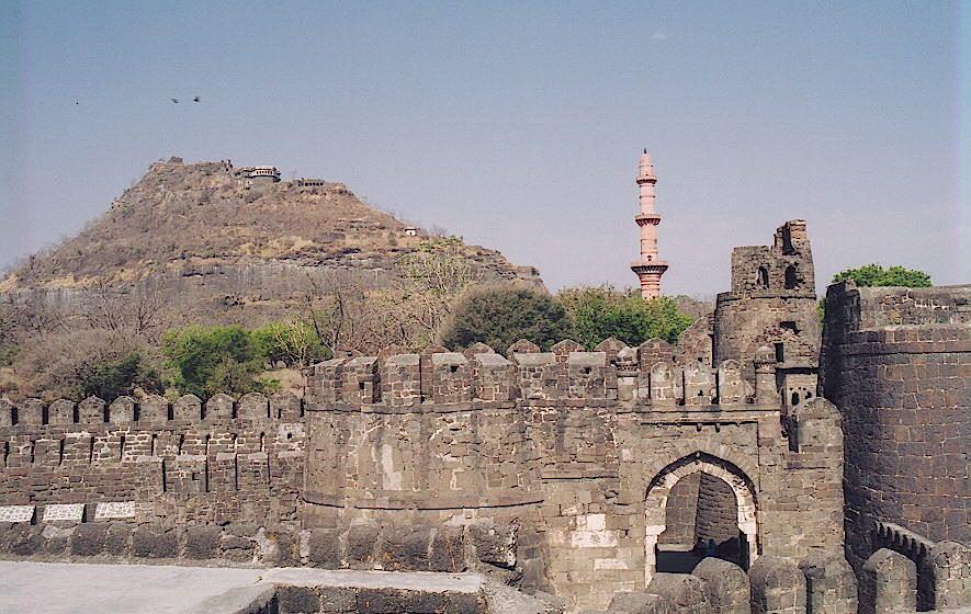
Daulatabad Fort, also known as Devagiri or Deogiri, is a historical fortified citadel located in Aurangabad, Maharashtra, India. It was the capital of the Yadava dynasty (9th century–14th century CE), for a brief time the capital of the Delhi Sultanate (1327–1334), and later a secondary capital of the Ahmadnagar Sultanate (1499–1636). Around the sixth century CE, Devagiri emerged as an important uplands town near present-day Aurangabad, along caravan routes going towards western and southern India. The historical triangular fortress in the city was initially built around 1187 by the first Yadava king, Bhillama V. In 1308, the city was annexed by Sultan Alauddin Khalji of the Delhi Sultanate, which ruled over most of the Indian subcontinent. In 1327, Sultan Muhammad bin Tughluq of the Delhi Sultanate renamed the city as “Daulatabad” and shifted his imperial capital to the city from Delhi, ordering a mass migration of Delhi’s population to Daulatabad. However, Muhammad bin Tughluq reversed his decision in 1334 and the capital of the Delhi Sultanate was shifted back from Daulatabad to Delhi. In 1499, Daulatabad became a part of the Ahmadnagar Sultanate, who used it as their secondary capital. In 1610, near Daulatabad Fort, the new city of Aurangabad, then named Khadki, was established to serve as the capital of the Ahmadnagar Sultanate by the Ethiopian military leader Malik Ambar, who was brought to India as a slave but rose to become a popular Prime Minister of the Ahmadnagar Sultanate. Most of the present-day fortification at Daulatabad Fort was constructed under the Ahmadnagar Sultanate.
RAJMACHI FORT, Khandala – Hills, Waterfalls, And Mist
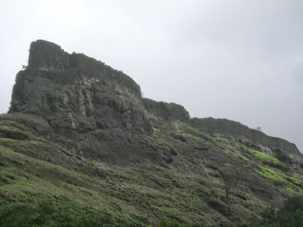
Rajmachi Fort (Killa) is one of the many historical forts in the rugged hills of Sahyadri mountains (Western Ghats). It consists of two twin fortresses Shriwardhan Ballekilla and Manaranjan Balekilla, with a wide machi (plateau) surrounding the two Balekillas. Udhewadi is a small village of about 60 households (as per 2011 census report) situated on the machi, at the southern foot of Manaranjan Balekilla of Rajmachi Fort There are two approaches to Fort Rajmachi, (a) from Lonavala and (b) from Kondivde or Kondhane village in Karjat Taluka of Raigad District. Lonavala – Rajmachi distance is 15 km and it is almost a plain walk, though there are a few ups and downs on this path. It takes about three and a half hour to cover the distance on foot. From Kondivde or Kondhane village, it is a steep climb up to Rajmachi. An experienced trekker takes about two and a half hour to climb up on this route. In case a Trekkers’ Group is not familiar with the Trek Route, they should hire a local Route Guide During the dry season after rains, i.e. from November to May, a strong and sturdy utility vehicle like Tata Sumo, Mahindra Bolero, Qualis, etc. can be taken right up to Udhewdi (Fort Rajmachi). The route is via Khandala, Kune village, Della Adventure Resort, Patel Dam, Phanasrai and Jambhali Phata. The initial section of this route up to Della Adventure Resort is a good road,
CHITRADURGA FORT, Karnataka – Picturesque Marvel From 17th Century
Chitradurga Fort or as the British called it Chitaldoorg, is a fortification that straddles several hills and a peak overlooking a flat valley in the Chitradurga District, Karnataka, India. The fort’s name Chitrakaldurga, which means ‘picturesque fort’ in Kannada, is the namesake of the town Chitradurga and its administrative district.
The fort was built in stages between the 11th and 13th centuries by the dynastic rulers of the region including the Chalukyas and Hoysalas, later the Nayakas of Chitradurga of the Vijayanagar Empire. The Nayakas of Chitradurga, or Palegar Nayakas, were most responsible for the expansion of the fort between the 15th and 18th centuries. The fort was taken over for a short while by Hyder Ali at Chitradurga in 1779. The fort was captured by the British forces twenty years later, when they defeated his son Tipu Sultan. The fort is built in a series of seven concentric fortification walls with various passages, a citadel, masjid, warehouses for grains and oil, water reservoirs and ancient temples. There are 18 temples in the upper fort and one huge temple in the lower fort. Among these temples, the oldest and most interesting is the Hidimbeshwara temple. The masjid was an addition during Hyder Ali’s rule. The fort’s many interconnecting tanks were used to harvest rainwater, and the fort was said to never suffer from a water shortage
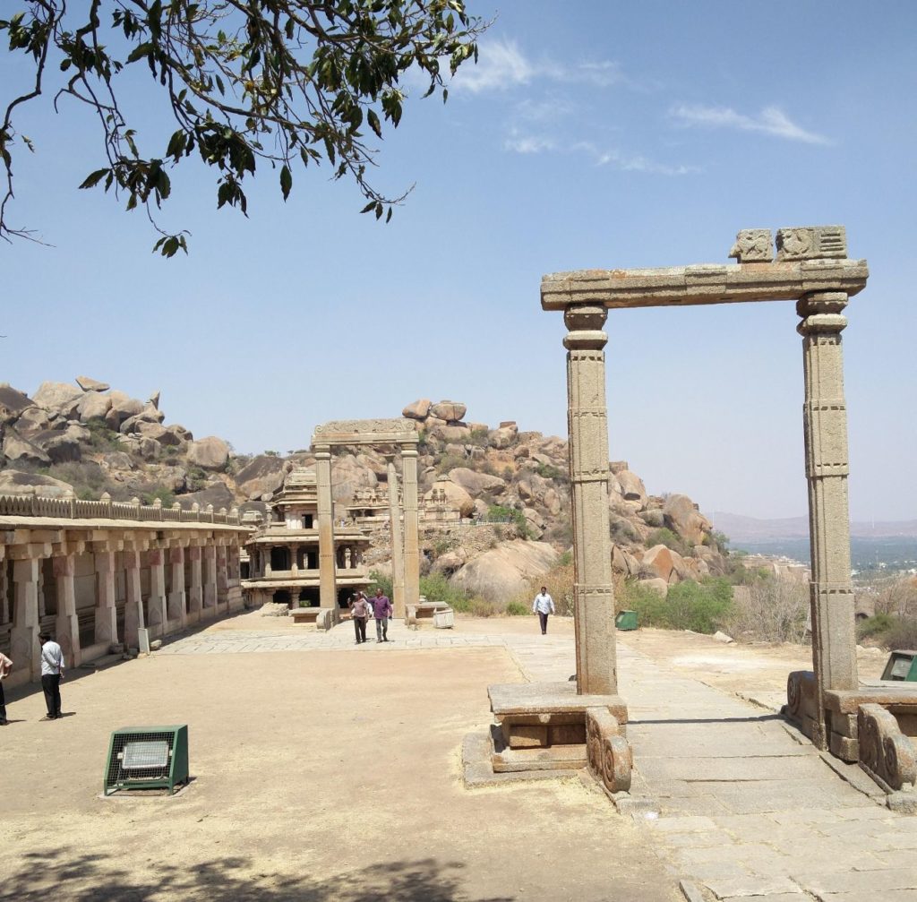
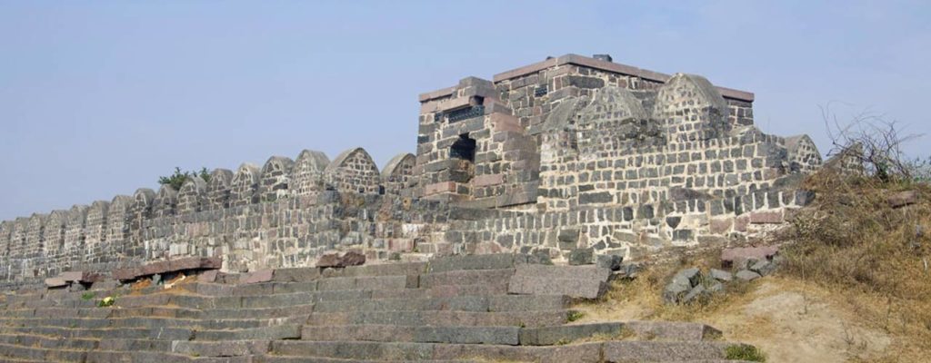
GOLCONDA FORT, Telangana – Displaying Architectural Brilliance
Golconda Fort, also known as Golkonda is a fortified citadel and an early capital city of the Qutb Shahi dynasty (c. 1512–1687), located in Hyderabad, Telangana, India. Because of the vicinity of diamond mines, especially Kollur Mine, Golconda flourished as a trade centre of large diamonds, known as the Golconda Diamonds. The region has produced some of the world’s most famous diamonds, including the colourless Koh-i-Noor (now owned by the United Kingdom), the blue Hope (United States), the pink Daria-i-Noor (Iran), the white Regent (France), the Dresden Green (Germany), and the colourless Orlov (Russia), Nizam and Jacob (India), as well as the now lost diamonds Florentine Yellow, Akbar Shah and Great Mogul.
Golconda was originally known as Mankal. Golconda Fort was first built by the Kakatiyas as part of their western defenses along the lines of the Kondapalli Fort. The city and the fortress were built on a granite hill that is 120 meters (390 ft) high, surrounded by massive battlements. The fort was rebuilt and strengthened by Rani Rudrama Devi and her successor Prataparudra. Later, the fort came under the control of the Musunuri Nayakas, who defeated the Tughlaqi army occupying Warangal. It was ceded by Musunuri Kapaya Nayaka to the Bahmani Sultanate as part of a treaty in 1364
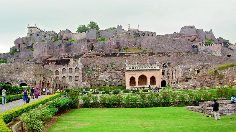
PANAHALA FORT, Kolhapur – The One With Double Walled Gates
Panahala fort was built between 1178 and 1209 CE, one of 15 forts (others including Bavda, Bhudargad, Satara, and Vishalgad) built by the Shilahara ruler Bhoja II. It is said that aphorism Kahaan Raja Bhoj, kahan Gangu Teli is associated with this fort. A copper plate found in Satara shows that Raja Bhoja held court at Panhala from 1191–1192 CE. About 1209–10, Bhoja Raja was defeated by Singhana (1209–1247), the most powerful of the Devgiri Yadavas, and the fort subsequently passed into the hands of the Yadavas. Apparently it was not well looked after and it passed through several local chiefs. In 1376 inscriptions record the settlement of Nabhapur to the south-east of the fort.
It was an outpost of the Bahamanis of Bidar. Mahmud Gawan, an influential prime minister, encamped here during the rainy season of 1469. On the establishment of the Adil Shahi dynasty of Bijapur in 1489, Panhala came under Bijapur and was fortified extensively. They built the strong ramparts and gateways of the fort which, according to tradition, took a hundred years to build. Numerous inscriptions in the fort refer to the reign of Ibrahim Adil Shah, probably Ibrahim I (1534–1557).
It was an outpost of the Bahamanis of Bidar. Mahmud Gawan, an influential prime minister, encamped here during the rainy season of 1469. On the establishment of the Adil Shahi dynasty of Bijapur in 1489, Panhala came under Bijapur and was fortified extensively. They built the strong ramparts and gateways of the fort which, according to tradition, took a hundred years to build. Numerous inscriptions in the fort refer to the reign of Ibrahim Adil Shah, probably Ibrahim I (1534–1557).
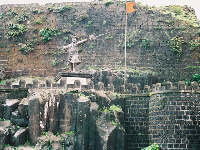
VISAPUR FORT, Khandala – An Escape From The City Life
It was built during 1713-1720 CE by Balaji Vishwanath, the first Peshwa of Maratha Empire. Visapur fort was built much later than Lohagad but the histories of the two forts are closely linked.In 1818, when reducing the Peshwa’s forts, the strength of Lohagad and its fame as the treasury of the Maratha kingdom, caused the English to make special preparations for its attack. A detachment of 380 European and 800 native soldiers, with a battering train, summoned from Konkan, were joined by artillery from Chakan, and two other British battalions. On 4 March 1818, Visapur was attacked and occupied.
Making use of its higher elevation and proximity to Lohagad, the British troops set up their cannons on Visapur and bombarded Lohagad, forcing the Marathas to flee. Thus, in 1818, Lohagad-Visapur was taken over by the British in 1818 AD and placed under the command of a Colonel Prother. Considering, the strategic importance of Visapur, both the north (Konkan) and the south (Deccan) gateways were blown up, and except a few huts, nothing was left standing. In contrast, most of Lohagad fort is still intact.
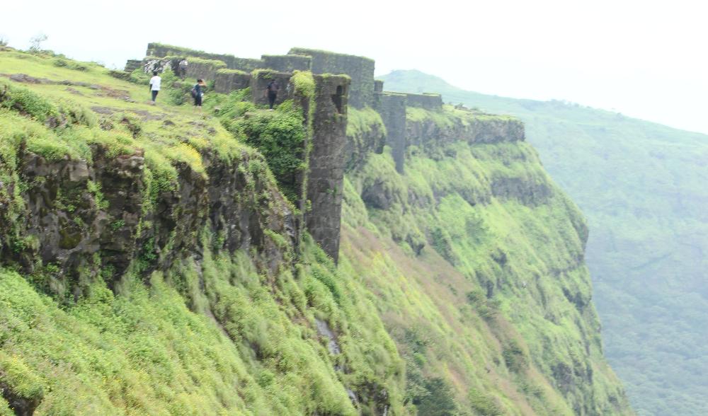
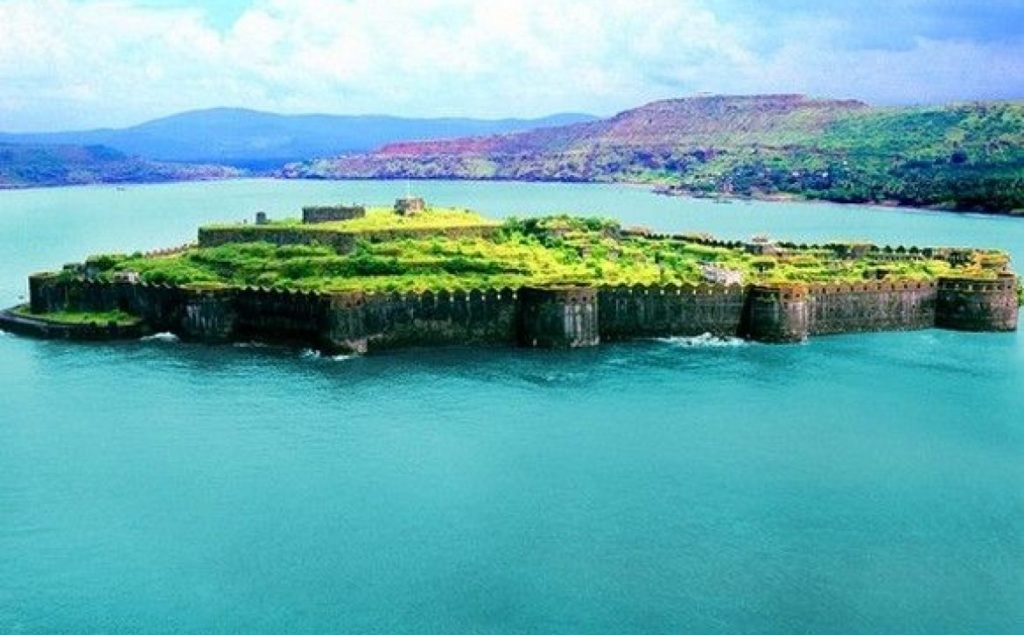
MURUD JANJIRA FORT , Raigad – The Strongest Sea Forts
Murud-Janjira Fort is situated on an oval-shaped rock off the Arabian Sea coast near the port city of Murud, 165 km (103 mi) south of Mumbai. Janjira is considered one of the strongest marine forts in India. The fort is approached by sailboats from Rajapuri jetty.The main gate of the fort faces Rajapuri on the shore and can be seen only when one is about 40 feet (12 m) away from it. It has a small postern gate towards the open sea for escape.The fort has 26 rounded bastions, still intact. There are many cannons of native and European make rusting on the bastions. Now in ruins, the fort in its heyday was a full-fledged living fort with all the necessary facilities, e.g., palaces, quarters for officers, mosque, two small 60-foot-deep (18 m) natural fresh water lakes, etc. On the outer wall flanking the main gate, there is a sculpture depicting a tiger-like beast clasping elephants in its claws.
The palace of the Nawabs of Janjira at Murud is still in good shape.A special attraction of this fort are 3 gigantic cannons named Kalalbangdi, Chavri and Landa Kasam. These cannons were said to be feared for their shooting range. Another gate to the west is sea-facing, called ‘Darya Darwaza’.
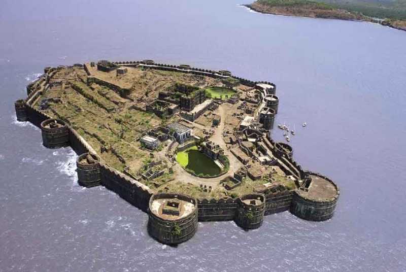
SINDHUDURG FORT, Maharashtra – Mighty Fortress On The Shore
Sindhudurg Fort is a historical fort that occupies an island in the Arabian Sea, just off the coast of Maharashtra in Western India. The fort was built by Shivaji. The fortress lies on the shore of Malvan town of Sindhudurg District in the Konkan region of Maharashtra, 450 kilometres (280 mi) south of Mumbai. It is a protected monument Sindhudurg island-fort was built by Chhatrapati Shivaji, the 17th-century ruler of Maratha Empire. Its main objective was to counter the rising influence of foreign colonizers (English, Dutch, French and Portuguese merchants) and to curb the rise of Siddis of Janjira . Construction was supervised by Hiroji Indulkar in 1664. The fort was built on a small island known as the Khurte island
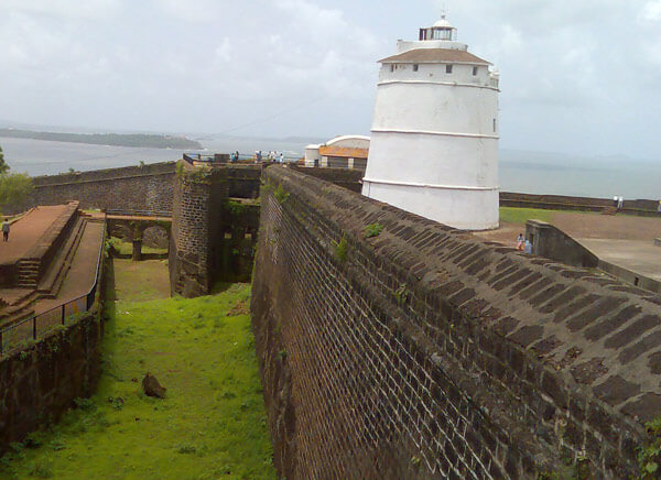
FORT AGUADA, Goa – The Dil Chahta Hai Fort
Fort Aguada is a well-preserved seventeenth-century Portuguese fort, along with a lighthouse, standing in Goa, India, on Sinquerim Beach, overlooking the Arabian Sea. It is an ASI protected Monument of National Importance in Goa. The fort was constructed in 1612 to guard against the Dutch and the Marathas. It was a reference point for the vessels coming from Europe at that time. This old Portuguese fort stands on the beach south of Candolim, at the shore of the Mandovi River. It was initially tasked with defence of shipping and the nearby Bardez sub-district.
A freshwater spring within the fort provided water supply to the ships that used to stop by. This is how the fort got its name: Aguada, meaning watery in the Portuguese language. Crews of passing ships would often visit to replenish their freshwater stores. On the fort stands a four-story Portuguese lighthouse, erected in 1864 and the oldest of its kind in Asia. Built in 1612, it was once the grandstand of 79 cannons. It has the capacity of storing 2,376,000 gallons of water, one of the biggest freshwater storage of the time in whole of Asia. This fort is divided in two segments: the upper part acted as fort and watering station, while the lower part served as a safe berth for Portuguese ships. Whereas the upper part has a moat, underground water storage chamber, gunpowder room, lighthouse, and bastions, it also has a secret escape passage to use during time of war and emergency. The lighthouse at the initial stage is used to emit light once in 7 minutes.
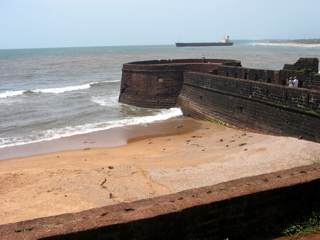
CHAPORA FORT, Bardez – Akbar’s Base Camp
Chapora Fort, located in Bardez, Goa, rises high above the Chapora River. The site was the location of a fort built by Muslim ruler Adil Shah called Shahpura, whose name the Portuguese altered to Chapora. It is now become a popular tourist spot and offers a view north across the Chapora river to Pernem, south over Vagator and also far out to the Arabian Sea in the West The fort changed hands several times after Portuguese acquired Bardez. Trying to end the Portuguese rule in Goa, Prince Akbar joined his father’s enemies, the Marathas in 1683 and made this place his base camp. It became the northern outpost of the Old Conquests. After the Portuguese recovered from an encounter with the Marathas, they strengthened their northern defences and provided shelter to the people there.
Across the Chapora river, the Hindu ruler of Pernem, the Maharaja of Sawantwadi who was an old enemy of the Portuguese held the fort for two years. The Portuguese came in 1717, and carried out extensive repairs of the fort, adding features like bastions and a tunnel that extended to the seashore and banks of the Chapora River for emergencies. The fort fell to Bhonsle in 1739. In 1741, the Portuguese regained the fort when the northern taluka of Pernem was handed over to them. In 1892, they completely abandoned the fort. When Goa’s border moved northwards with the acquisition of Pernem as part of the New Conquests, the fort lost its military significance towards the end of the century.
BEKAL FORT, Kerala – The Largest Fort In Town
Bekal Fort was built by Shivappa Nayaka of Keladi in 1650 AD, at Bekal. It is the largest fort in Kerala, spreading over 40 acres (160,000 m2). During the Perumal Age Bekal was a part of Mahodayapuram. Following the decline of Mahodayapuram Perumals, Bekal came under the sovereignty of the Mushika or Kolathiri or Chirakkal Royal Family in the 12th century. The maritime importance of Bekal increased under the Kolathiris and Malabar became an important port town.After the Battle of Talikota in 1565 feudatory chieftains including the Keladi Nayakas (Ikkeri Nayaks) became powerful in the region. Bekal served as a hub to first dominate, then later defend Malabar. The economic importance of this port town prompted the Nayakas to fortify Bekal subsequently. Hiriya Venkatappa Nayaka initiated the construction of the fort and it was completed in 1650 AD by Shivappa Nayaka. Chandragiri fort near Kasargod was also built during this period.The struggles between the Kolathiries and Nayaks to hold this area ended when Hyder Ali conquered the Nayakas and Bekal fell into the hands of Mysore kings.
It was an important military station for Tipu Sultan when he led a military expedition to capture Malabar. The coins and artefacts found in archaeological excavations at Bekal fort indicate the strong presence of Mysore Sultans. Tipu Sultan’s death during the Fourth Anglo-Mysore War ended Mysorean control in 1799. The fort came under the British East India Company’s control and became the headquarters of the Bekal Taluk of South Canara District in Bombay presidency. The political and economic importance of Bekal and its port declined.
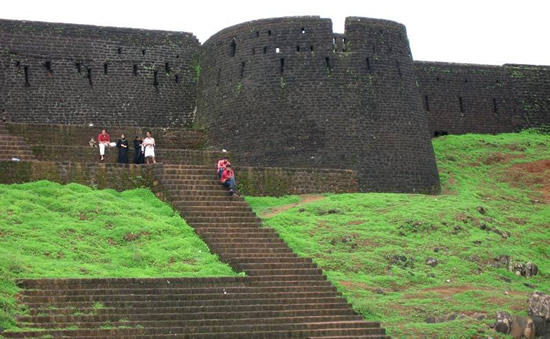
RED FORT , Delhi – Fort With An Inspiring Architecture
The Red Fort is a historic fort in the city of Delhi (in Old Delhi) in India that served as the main residence of the Mughal Emperors. Emperor Shah Jahan commissioned construction of the Red Fort on 12 May 1638, when he decided to shift his capital from Agra to Delhi. Originally red and white, its design is credited to architect Ustad Ahmad Lahori, who also constructed the Taj Mahal. It was constructed between May 1639 and April 1648.
Constructed in 1639 by the fifth Mughal Emperor Shah Jahan as the palace of his fortified capital Shahjahanabad, the Red Fort is named for its massive enclosing walls of red sandstone. The imperial apartments consist of a row of pavilions, connected by a water channel known as the Stream of Paradise (Nahr-i-Bihisht). The fort complex is “considered to represent the zenith of Mughal creativity under Shah Jahan”
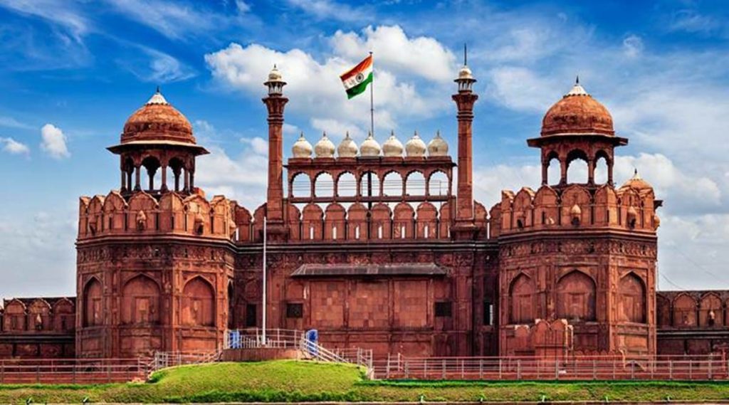
AGRA FORT , Uttar Pradesh – Former Residence Of Mughals
Agra Fort is a historical fort in the city of Agra in India. It was the main residence of the emperors of the Mughal Dynasty until 1638, when the capital was shifted from Agra to Delhi. Before capture by the British, the last Indian rulers to have occupied it were the Marathas. In 1983, the Agra fort was inscribed as a UNESCO World Heritage site. It is about 2.5 km northwest of its more famous sister monument, the Taj Mahal. The fort can be more accurately described as a walled city.It had been used by the early mughal rulers. The Fort stands on an ancient site and was traditionally known as Badalgarh. It was captured by Ghaznavi for some time but in the 15th century A.D. the Chauhan Rajputs occupied it. Soon after, Agra assumed the status of capital when Sikandar Lodi (A.D. 1487–1517) shifted his capital from Delhi and constructed a few buildings in the pre-existing Fort at Agra. After the first battle of Panipat (A.D. 1526) Mughals captured the fort and ruled from it. In A.D. 1530, Humayun was crowned in it. The Fort got its present appearance during the reign of Akbar (A.D. 1556–1605).
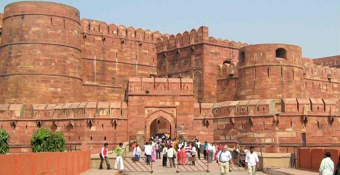
JUNAGARH FORT, Rajasthan – Pride Of Thar
Junagarh Fort is a fort in the city of Bikaner, Rajasthan, India. The fort was originally called Chintamani and was renamed Junagarh or “Old Fort” in the early 20th century when the ruling family moved to Lalgarh Palace outside the fort limits. It is one of the few major forts in Rajasthan which is not built on a hilltop. The modern city of Bikaner has developed around the fort. This fort was built in 1478 by Rao Bika who established the city of Bikaner in 1472. Rao Bika was the second son of Maharaja Rao Jodha of the Rathor clan
The fort complex was built under the supervision of Karan Chand, the Prime Minister of Raja Rai Singh, the sixth ruler of Bikaner, who ruled from 1571 to 1611 AD. Construction of the walls and associated moat commenced in 1589 and was completed in 1594. It was built outside the original fort of the city (the first fort built by Rao Bikaji), about 1.5 kilometres (0.93 mi) from the city centre. Some remnants of the old fort are preserved near the Lakshmi Narayan temple.
Historical records reveal that despite the repeated attacks by enemies to capture the fort, it was not taken, except for a lone one-day occupation by Kamran Mirza. Kamran was the second son of the Mughal Emperor Babur who attacked Bikaner in 1534, which was then ruled by Rao Jait Singh.
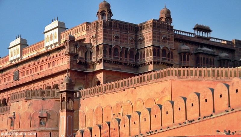
WARANGAL FORT , Telangana – Emblem Of Telangana
Warangal Fort is located in Warangal District, Telangana, India. It was the capital city of Kakatiyas and Musunuri Nayakas. It appears to have existed since at least the 12th century when it was the capital of the Kakatiya dynasty. The fort has four ornamental gates, known as Kakatiya Kala Thoranam, that originally formed the entrances to a now ruined great Shiva temple. The Kakatiyan arch has been adopted and officially incorporated into the emblem of Telangana after the state bifurcation. The Fort is included in the “tentative list” of UNESCO World Heritage Site. The Monument was submitted by the Permanent Delegation of India to UNESCO on 10/09/2010.
Warangal was under the rule of the Yadava kings in the 8th century; in the 12th century, it came under the control of the Kakatiya dynasty. Although precise dating of its construction and subsequent enhancements is uncertain, historians and archaeologists generally agree that an earlier brick-walled structure was replaced with stone by Ganapatideva, who died in 1262, and that he was succeeded by his daughter Rudrama Devi, who ruled until 1289, and then her grandson Prataparudra II, whose reign came to be known as a “Golden Age”. Twenty years later his kingdom was conquered by the Sultans of Delhi.
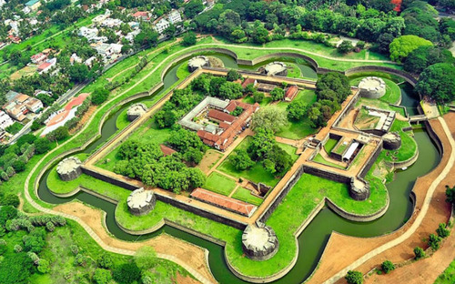
PALAKKAD FORT Fort, Kerala – Blend Of History And Nature
Palakkad Fort is an old fort situated in the heart of Palakkad town of Kerala state, southern India. It was recaptured and rebuilt grandly by Sultan Hyder Ali in 1766 ACE and remains one of the best preserved forts in Kerala. The Palakkad Fort is said to have existed from very ancient times, but believed to be constructed in present form in 1766 A.D, but little is known of its early history. The local ruler, Palakkad Achchan, was originally a tributary of the Zamorin, but had become independent before the beginning of the eighteenth century. In 1757 he sent a deputation to Hyder Ali seeking help against an invasion threatened by the Zamorin. Hyder Ali seized upon the opportunity to gain possession of a strategically important location such as Palghat and from that time until 1790 the fort was continually in the hands of the Mysore Sultans or the British. It was first taken by the latter in 1768 when Colonel Wood captured it during his raid on Hyder Ali’s fortresses, but it was retaken by Haider a few months later. It was recaptured by Colonel Fullarton in 1783, after a siege that lasted eleven days but was abandoned the following year. It later fell into the hands of the Zamorin’s troops. In 1790 it was finally captured by the British under Colonel Stuart. It was renovated and was used as a base for operations that ended with the storming of Srirangapatnam. The fort continued to be garrisoned until the middle of 19th century. In the early 1900s it was converted into a taluk office.
SRIRANGAPATNA FORT, Karnataka – Pride Of Karnataka
Srirangapatna Fort is a historical fort located in Srirangapatna, the historical capital city in the South Indian state of Karnataka. Built by the Timmanna Nayaka in 1454. The fort was fully fortified and the architecture was modified with the help of French architects to meet the growing needs of saving against invaders. The river Kaveri surrounds the fort in one of the sides. The fort is protected in the West and Northern directions by river Cauvery. The fort had Lal Mahal and Tipu’s palace, which were demolished during the British capture of 1799. There are seven outlets and two dungeons.
Colonel Bailey’s Dungeon, Daria Daulat Bagh, Gumbaj containing tomb of Tipu Sultan, Juma Masjid (Masjid-E-Ala), Obelisk monuments and Fort walls near the breach, spot where Tipu’s Body was found, Sri Kanthirava statue in Narasimha Temple, Sri Ranganatha Svami Temple and Thomas Inman’s Dungeon are maintained as protected monuments under the Bangalore Circle of the Archaeological Survey of India. The fort is believed to have been built by Timmanna Nayaka, a ruler of Vijayanagar Empire in 1454 CE. The fort was in the hands of the Empire till 1495 when the Wodeyars overpowered the Vijayanagar rulers. The fort was subsequently changing hands between Nawab of Arcot, Peshwas and the Marathas.
